We usually alternate between two different spots, one we call Red Feather but it’s well beyond Red Feather closer to Lost Lake. We also go to a place we usually call Pingree Park but it is not on the CSU Campus or even close, but it is along a road usually referred to as “Pingree Park Road” off Poudre Canyon Rd/Hwy14. Sometimes we go wild and leave Larimer County but that is not planned for this coming year. (2022)
Be sure to check here for the most up to date information about where we will be camping as well as alternative sites we may relocate do in the event there are problems at the usual site. Cell coverage is getting better at Lost Lake but be aware you may not be able to reach us to find the directions.
Pingree Park: This area was in flux the last time someone visited. Check back closer to a camping event and we should have the location, at least close to it.
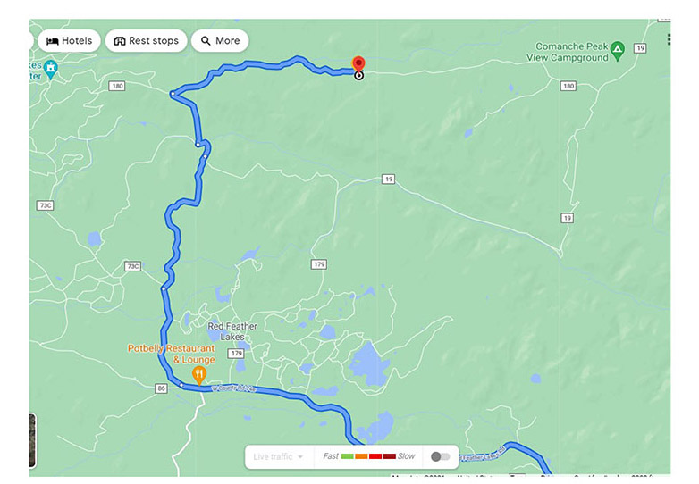
Red Feather/Lost Lake: Where we usually camp is pretty far away. You go around Red Feather and continue north and east for some time. We hope to get our usual camping site but if we aren’t there, keep going down the road and we will hopefully be there.
NCCR Camping Directions to Red Feather Lakes/Lost Lake
https://goo.gl/maps/kaefrDU74VVgy8fo8
GPS: 40.84917, -105.5611
CAUTION: Portions of this road are a little rutted or rough, please once on the dirt road drive with caution. There are many ruts and potholes which could damage some cars. Having said that we made it in the Prius just fine, there are ways around the holes and ruts in all areas. Also, parts of the dirt road are very, very narrow and become a 1 lane width at times. Please watch your speed around blind corners especially.
Directions:
Take 287 North out of Fort Collins passing Ted’s Place to Livermore.
Turn left onto W County Rd 74E towards Red Feather Lakes.
(The landmark will be the “Forks” restaurant and general store)
Follow 74E through the town of Red Feather Lakes Village. Stay on 74E.
The road will change names to 73C, stay on 73C which is a slight jog to the right. The other name of 73C is Creedmore Lakes Rd. 74E goes slightly left.
The road will change to a dirt road.
Landmarks to ensure you are on the right road include the elementary school and Fey Drive.
You will see a sign for Beaver Meadows Ranch, at this point take the road right.
The road again changes names to Chicken Park Rd though there are no signs with this name. This is for the folks following along on GPS.
When you get to the sign for Creedmore Lakes and Lost Lake, turn right towards Lost Lake.

Stay on this road until you pass the cattle guard.
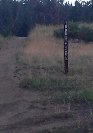
Our camp site is on the right hand side of the road about 2 miles further than them. We will put our green NCCR signs up by the road, but you will also see the trailhead sign and mile marker there. Turn right at this sign.
Once you pass this point we will have a second NCCR sign marking which leg of the fork in the road to take to reach us.